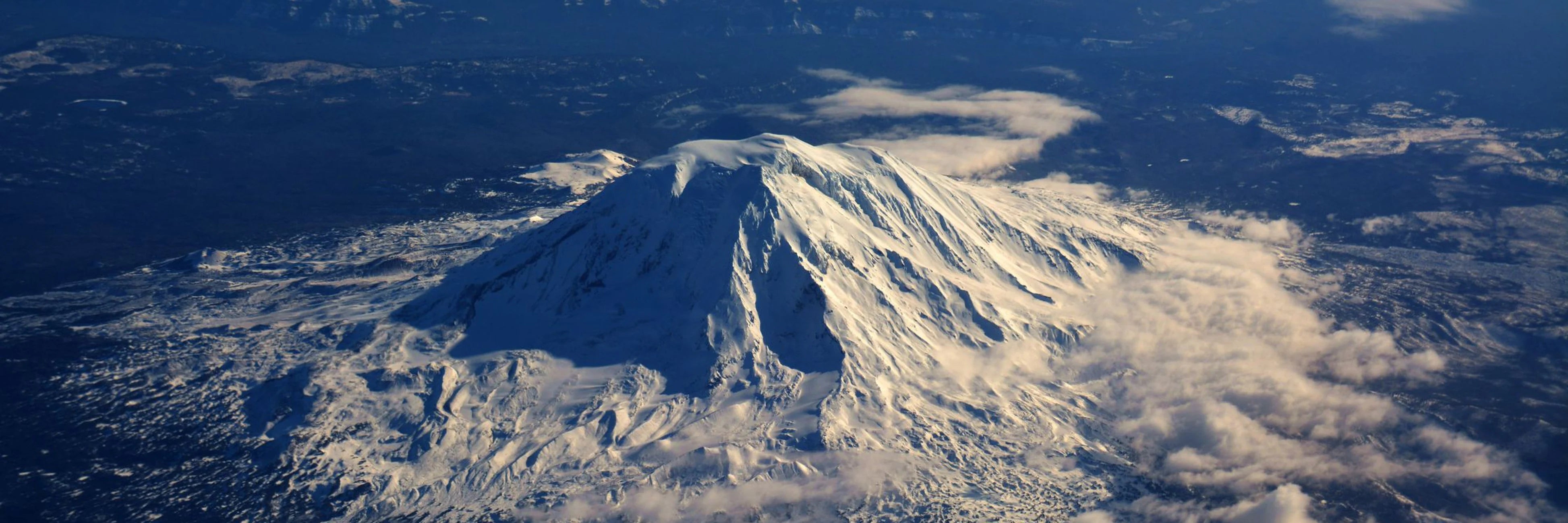
The stratovolcano Mount St. Helens erupted at precisely 08:32, Sunday, May 18th 1980 following a magnitude 5.1 earthquake causing the largest landslide in recorded history and an ash plume rising over 24km, ultimately claiming the lives of 57 people, thousands of animals and plant life and costing $1.1 billion in damage.
One of the worst natural disasters in U.S. history, we investigate what caused such a cataclysmic event, the details, impact and what the future holds for this quiescent but volatile peak.
Causes of the eruption of Mount St. Helens
Mount St. Helens is located on the plate boundary of the continental North American Plate and the oceanic Juan De Fuca Plate. The eruption of 1980 occurred as the lighter and less dense oceanic plate subducts, i.e., is forced underneath, the denser continental plate.
As the oceanic plate is forced under, it melts turning into magma which rises towards the Earth's surface. Moreover, seawater that is pulled through the subduction zone turns immediately into steam when it makes contact with the magma causing pressure to increase causing the potential for a violent explosion.
Precursory activity
However, it wasn't until March 20th 1980, that a 4.2 magnitude earthquake just off St. Helens' north flank flagged the end of its 123-year dormancy. After hundreds of additional earthquakes, on March 27th, magma suddenly heating groundwater caused explosions of steam sending ash 3km above the vent creating a new crater 75m wide.
Within a week the crater had grown to 400m across. Eruptions, averaging 1 per hour in March, had eased to 1-per day by April 22nd until activity ceased. Small eruptions then resumed from May 7th-May 17th with the north flank growing outward creating a protruding bulge of 140m. This 'cryptodome' grew outward at a rate of two metres per day. This was clear evidence of magma rising high into the volcano.
Details of the May 1980 eruption of Mount St. Helens
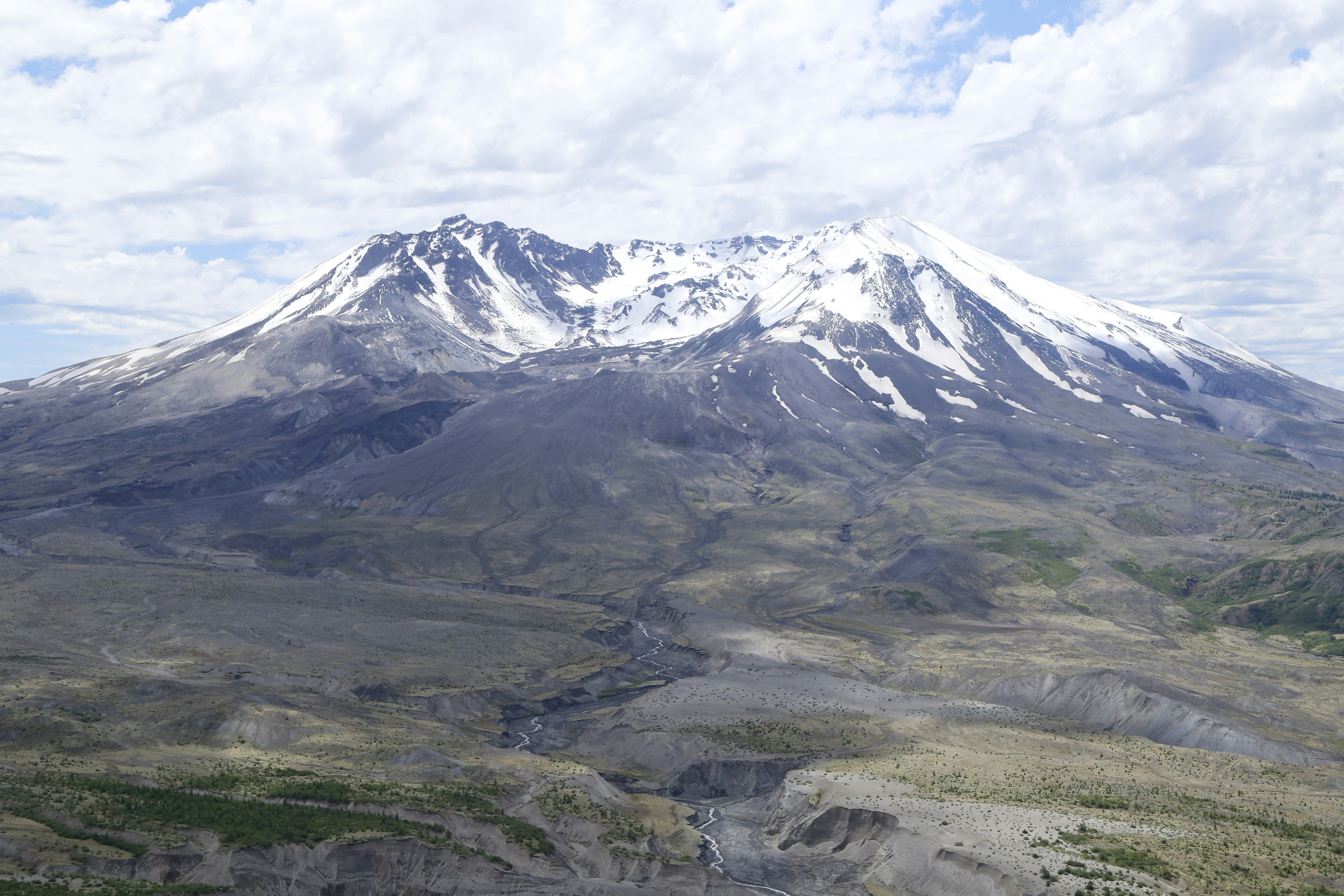
Without warning, a 5.1 magnitude earthquake occurred on May 18th at 08:32 which was the spark that lit the bonfire. As a result, St. Helens' northern bulge and summit collapsed causing the largest debris avalanche – landslide – in earth's recorded history. The debris avalanche crashed down the side of the volcano and over ridges covering 23 miles and travelling at speeds of over 100mph destroying everything in its path. The total volume of the avalanche was approximately 2.5 billion cubic meters or 1 million Olympic swimming pools.
The landslide caused the removal of the cryptodome – a very hot and highly pressurised body of magma – which immediately depressurised the volcano triggering a significant eruption. This blasted laterally through the gap in the volcano caused by the landslide and also removed 300m of the volcano's cone. Within 15-minutes, an ash cloud had risen to 24km. During the subsequent nine hours of intense volcanic activity, 540,000,000 tonnes of ash fell from this volcanic tempest, as far as Minnesota and Oklahoma. Areas as far as Spokane were even plunged into darkness due to the ubiquity of ash.
More significantly, however, the lateral blast caused a pyroclastic flow – a fast-moving torrent of exceptionally hot gas and volcanic matter – which hugged the ground of the volcano accelerating to above the speed of sound (767mph) exceeding temperatures of 400 degrees Celsius incinerating anything unfortunate to be in its path. In total, an area of 1,147km2 was destroyed by the 1980 Mount St. Helens pyroclastic flows.
As, at the time of the eruption, Mount St. Helens was covered with glaciers and overlaying snow the heat of exploding volcano created huge lahars (volcanic mudflows). These lahars were about the consistency of wet concrete but travelled up to 90mph. These ultimately followed the paths of rivers and creeks for over 40km, however, due to the added 14,000,000m3 of water, mud and debris, they took out bridges crossing Pine Creek and Swift Reservoir.
To put the eruption of Mount St. Helens into perspective, the May 1980 eruption is rated 5 out of 8 or "very large" on the Volcanic Explosivity Index (VEI). A ranking of 5 or higher occurs worldwide, on average, once every two decades. The ranking of 5 reflects the extreme power of the lateral blast, but the relatively small output of magma.
The 1980 eruption is also referred to as a Plinian eruption, due to its similarity to the eruption of Mount Vesuvius in 79AD which destroyed the ancient cities of Pompeii and Herculaneum. However, the explosivity only measures the eruption itself, not its impact, and whilst larger eruptions have occurred more, their relative isolation has meant they have had a smaller impact on human life.
The impact of the 1980 eruption of Mount St. Helens
The 1980 eruption of Mount St. Helens is the deadliest and most economically costly volcanic eruption in the history of the contiguous United States. 57 people lost their life. The death toll included geologist David Johnston, who witnessed the collapse of the north face from an observation post atop a ridge 5 miles from St. Helen, radioing in to cry "Vancouver! Vancouver! This is it!" before being deluged by the resulting pyroclastic flow, and Gerry Martin whose last words whilst working for the Department of Emergency Services and seeing the demolition of the observation post were "It's going to get me too". Autopsies showed that most people killed likely died from asphyxiation after inhaling hot ash.
Beyond the tragedies of human life there was also a natural cost. In total, 600km2 of forests were destroyed resulting from either being obliterated by pyroclastic flows or extreme heat where trees remained standing but were signed by hot gases. The rain of ash carried by the prevailing wind also destroyed many surrounding agricultural crops. Animals such as Elk, Deer and salmon were either lost to the flows or due to habitat destruction.
Not only was the eruption of Mount St. Helens the deadliest in U.S. history, but it was also the most economically damaging. The International Trade Commission estimated the cost of the eruption to be $1.1 billion. All manmade structures in the vicinity of Spirit Lake were buried and more than 200 houses and cabins were destroyed in Skamania and Cowlitz Counties. Over a thousand commercial flights were cancelled and 185 miles of road and 15 miles of railway were destroyed or extensively damaged. Ashfall created havoc with transportation, sewage and water treatment. It was costly to remove too, it costed $2.2 million and took 10-weeks to remove ash from Yakima. To combat this cost, Congress appropriated $951 million for disaster relief.
The Future of Mount St. Helens
At the time of the eruption, the summit was owned by a railroad but was later donated to the United States Forest Service and in 1982, became preserved in the Mount St. Helens National Volcanic Monument – an area of 445km2 for research, recreation and education. The creation of the monument has helped to make Mount St. Helens one of the foremost sites of volcanology in the world. Beyond the monitoring of volcanic activity, researchers have also documented the return of natural life to the previously devasted area, finding extremely diverse and unique ecosystems.
Significant volcanic activity on Mount St. Helens was last recorded between 2004 and 2008 as magma continually, but gradually extruded from a vent but did not breach the walls of the creator formed by the 1980 eruption. Currently, Mount St. Helens is abeyant and you're free to summit its crater, however, as the most active volcano in the Cascade volcanic arc, it will erupt into life again. It's just a question of when not if.
 3 min readLayers for AdventuresRead post
 Celebrating International Women's DayRead post
 7 min readMaking The Most Of A Trip To The North Cascade National ParkRead post
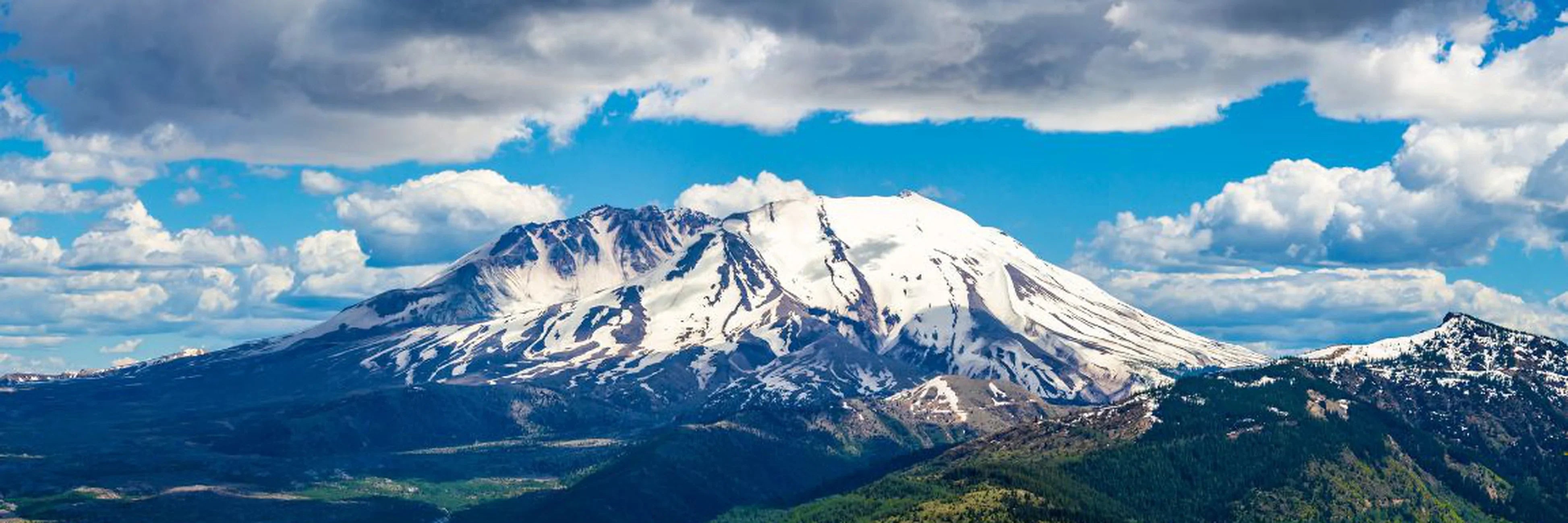 Adventure5 min readNational Parks Across the Cascade RangeRead post
 Adventure11 min readThe Cascade Volcanic ArcRead post
 Adventure4 min readHow To Hike The Cascade PassRead post
 Adventure6 min readVisiting Swayambhu Mahachaitya, the Monkey TempleRead post
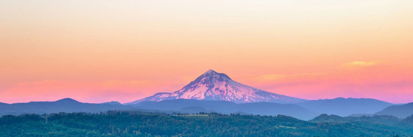 Adventure12 min readHow To Climb Mount HoodRead post


