The Cascade Range
This article offers a comprehensive guide on The Cascade Range is a mountain range that runs for 700 miles from North California to British Columbia in Canada with several peaks reaching over 3,000 metres caused by the collision of two tectonic plates. This mountain range is less well-known than other U.S. ranges such as the Rockies or the Appalachians but is equally as fascinating.
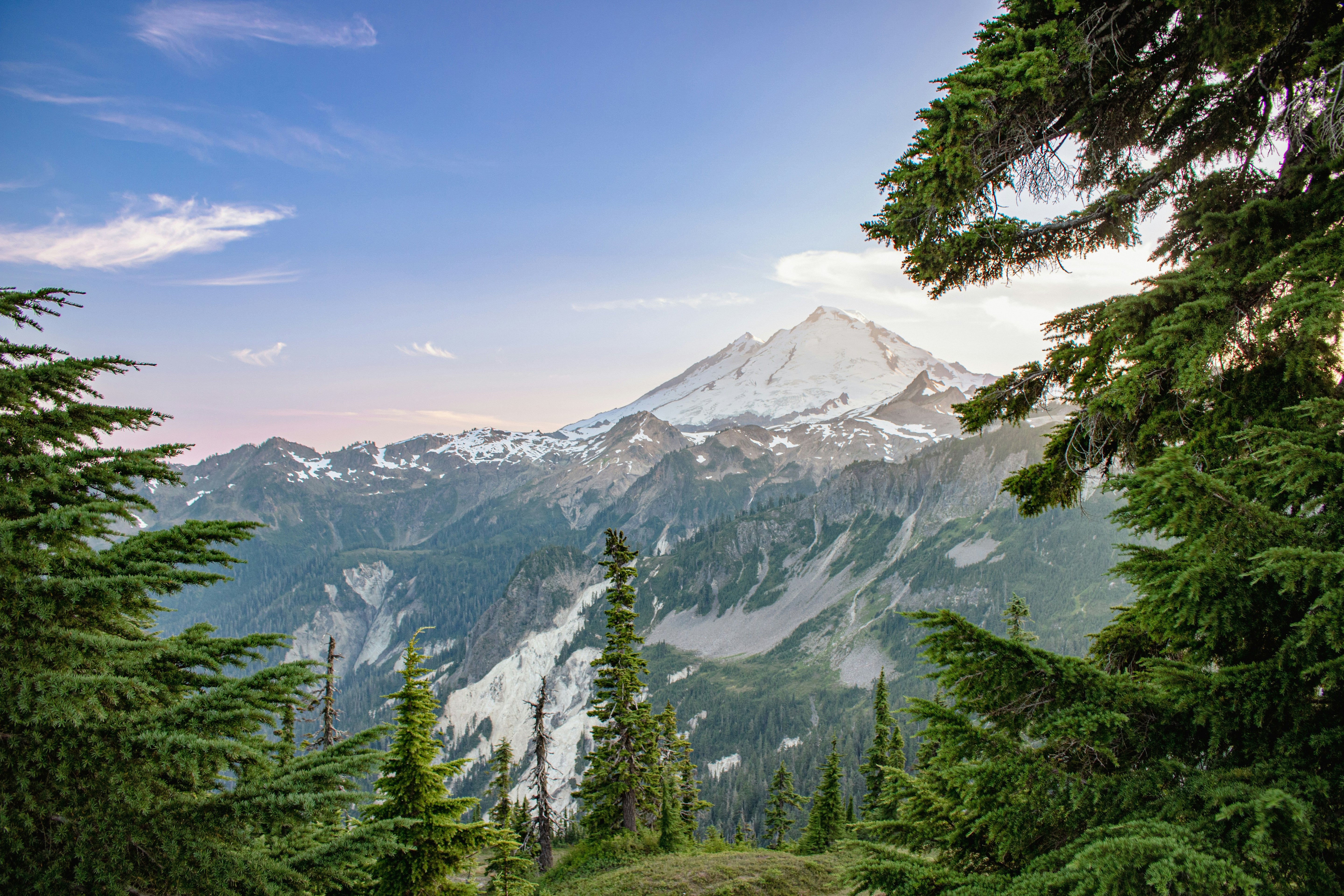
The Cascade Range is America's land of fire and ice. From the snow-capped peaks of its giants including Mount Rainier at 4,392m to volatile volcanoes such as Mount St. Helens, it is as diverse as it is beautiful. Being more below the radar, The Cascade Range remains largely under-explored.
This article offers a comprehensive guide on The Cascades including its geography, such as how it was formed, its history, such as its early exploration, how we can explore it today such as its best hiking trails and some of the amazing flora and fauna on offer.
1. Introduction to the Cascade Range
The Cascade Range is a mountain range stretching for 700 miles from British Columbia in the North to California in the South. It, therefore, ascends through three U.S states starting at Lassen Peak in Northern California, then traversing through Oregon and Washington before concluding at the Fraser River in British Columbia.
The Cascade Range is continued by the Sierra Nevada in the South, California's most well-renowned mountain range, and the Coast Mountains to the North. The Cascade Range forms a section of the American Cordillera (chain of mountain ranges) that stretches from Alaska to the tip of South America.
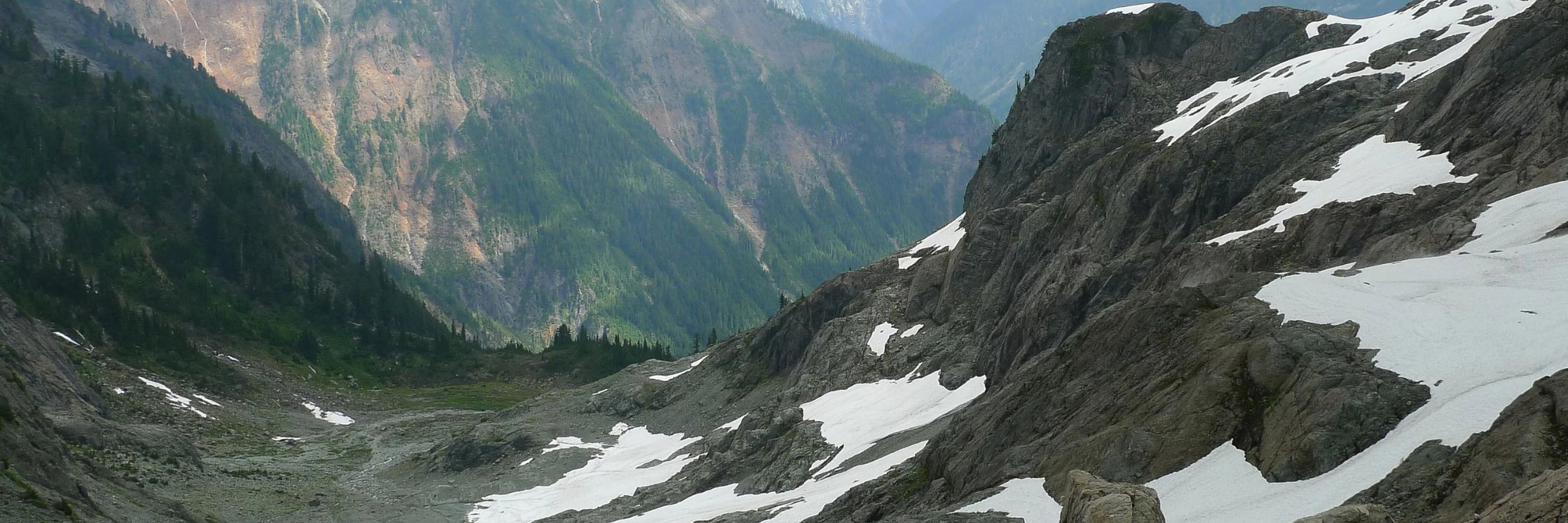
The Cascades include many peaks that rise well above 3,000m, containing both non-volcanic mountains which are principally found in a section known as the North Cascades, and active volcanoes most commonly found in the High Cascades. The highest peak in the Cascade Range is Mount Rainier, an active stratovolcano that rises 4,392m. The Cascades form part of the Pacific's Ring of Fire – a region around the circumference of the Pacific Ocean where 75% of Earth's volcanic eruptions and 90% of earthquakes occur due to the collision and destruction of tectonic plates.
Indeed, in the contiguous U.S i.e., excluding Hawaii and Alaska, every volcanic eruption in the previous two centuries has come from a volcano in the Cascade Range. The most recent activity was the eruptions of Lassen Peak from 1914 to 1921 and a major eruption of Mount St. Helens in 1980 with minor eruptions again between 2004 to 2008. Despite being famed for its unruliness, the Cascade Range is also home to stunning Douglas fir forests, waterfalls and lakes thanks to it receiving up to 100 inches of precipitation each year.
Not only is it a geography student's idea of heaven, but anyone who values the outdoors will love the curious natural formations and vast vistas that the Cascades provide.
Native people were not static and moved through their territories to gather resources from mountains, land and sea. In winter months, indigenous people gathered along riverbanks to capture the first runs of salmon and herring. Through spring and summer, sprouts, greens, roots, and berries were collected with autumn being prime time for duck and deer/elk hunting. Throughout the winter, native people would also rely on stored resources.
Beyond food, the Cascades also provided indigenous peoples with rich materials. Native men would create planks and posts for houses or canoes with cedarwood whilst women would combine mountain goat wool, dog hair and fireweed fluff for blankets and clothing. Native people had a mastery of their landscape with evidence of burning prairies to encourage new bulb growth and advanced fishing technologies.
However, the segregation of native peoples along the Cascade Range was not unvarying. Trade networks and routes were established to share and barter resources. The now popular hiking route, the Cascade Pass, was labelled Stehekin – "the way through". The Cascade Range was not only used as a trade route, however, and evidence shows that native peoples did populate the mountains most commonly throughout spring and summer.
The first European exploration of the Cascade Range in 1792 started a period of dramatic change in native life. From this point, the settlement history often reflected the inimical impact of diseases such as smallpox and measles, displacement as American settlers poured into Puget Sound, violence because of treaty violations and the loss of native tenured land. When exploring the beautiful Cascade Range it is important to acknowledge the original stewards of the land and examine our relationship with indigenous communities whose identities are inextricably linked to it.
2. British Exploration of the Cascade Range
In 1792, English navigator George Vancouver entered Puget Sound, an inlet along the north-western coast of Washington, as part of his Vancouver Expedition. The voyage was part diplomatic and part exploratory in nature as Vancouver would take immense care in surveying the intricate details of coasts and channels. The voyage in total took over four years with Vancouver circumnavigating the globe, making contact with 5 continents.
Upon entering Puget Sound, Vancouver would give names to the snowy capped mountains that he could see from HMS Discovery. Whilst native tribes had named the peaks well before Vancouver, these are the names that we are now most familiar with. Mount Baker was named after Vancouver's third lieutenant, Joseph Baker, Mount Rainier was named after Vancouver's naval friend Peter Rainier, Mount St. Helens after Alleyne FitzHerbert, 1st Baron St Helens and Mount Hood after Lord Samuel Hood, an admiral of the Royal Navy. Vancouver did not name the Cascade Range himself, however, instead referring it to the 'Eastern Snowy Range'.
3. 19th Century History of the Cascade Range
In 1803, President Thomas Jefferson commissioned the Lewis and Clarke Expedition shortly after the Louisiana Purchase to explore and map the newly acquired western territory and find a practical route across to the western coast. They passed through the Cascades via the Columbia River which became the only viable way to pass that part of the range for many years. The Cascade Rapids, a stretch along the Columbia River where it drops 12 meters in two miles was the last obstacle the expedition, along with the many traders that followed met. The mountains in the background became known as the 'mountains by the Cascades' and later simply as the "Cascades".
Settlement in the Cascade region was slow to develop due to the difficulty of crossing the North Cascades and the dearth of beaver for trading. This was accelerated, however, by the establishment of Hudson's Bay Company, a fur-trading firm, close to today's city of Portland. Trapping parties were the first to explore the southern Cascades in the 1820s and 1830s using what is now known as the Siskiyou Trail venturing into California establishing trails passing Mount Shasta and Lassen Peak.
The Cascades became the centre of a political dispute during the 1840s. After the inconclusive war of 1812, a series of treaties left residual territorial rights to a disputed area of Oregon between the British Empire and the United States. The United States rejected the proposed boundary at the spine of the Cascade Range and instead insisted on the 49th parallel North, cutting across the range just north of Mount Baker, an agreement ratified in the 1846 Oregon Treaty.
The treaty resulted in an influx of migration along the Oregon trail leading to the exploration and population of Washington. Whilst railways and later freeways followed, the Cascade Range remains largely untouched with much of the Northern Cascades protected by national or provincial parks.
4. Geography of the Cascade Range
The Cascade Range was formed due to the collision and subduction of the Juan de Fuca oceanic plate under the North American plate causing the buckling and folding of plates creating an uplift. The reason for the Cascade volcanoes, otherwise known as the Cascade Arc, is a result of a process called subduction. The Cascade Arc includes 20 major volcanoes along with 4,000 separate volcanic vents.
The Cascadia subduction zone occurs along a 680-mile faultline running 50 miles off the western coast. Here, the denser oceanic plate is 'subducted' i.e. forced underneath, the continental plate. As it is subducted, the plate heats up as it descends to greater depths and water is gradually released from the sediments and minerals within the plate slab. This decreases the melting temperature of the mantle which melts to form magma. The newly formed magma then rises toward to earth's surface to erupt forming a chain of volcanoes i.e. the Cascade Arc above and along the subduction zone.
5. History of Volcanic Activity
Volcanism in the Cascades has a 40 million year history, starting when ancient volcanoes first pushed through ocean waters. Twenty million years later, continual eruptions created a layer of rock several kilometres thick to form the backbone of the Cascade Range. A mere two million years ago, eruptions began the construction of cinder cones. Mount Rainier's volcanic cone, for example, is around 500,000 years old. Whilst this may seem ancient, the Cascade Range is considered rather young. The Appalachian Mountains are 250 million years old in comparison.
Since the Declaration of Independence in 1776, at least 7 Cascade volcanoes have erupted. Whilst the frequency of eruptions varies between volcanoes, with some lying dormant for thousands of years before an eruptive period, on average a volcano will erupt in the Cascade Range once or twice per century. Lassen Peak erupted between 1914-17 and Mount St. Helens most violently in 1980 and then again between 2004-2008.
6. Topography
The tallest peaks of the Cascades are referred to as the High Cascades and often dominate their surroundings standing twice the height of their surroundings frequently standing over a mile above other crest lines. The tallest peaks such as Mount Rainier at 4,392m dominate their locale. The North Cascades, the northern part of the range above Mount Rainier is exceptionally rugged featuring steep and glaciated peaks with low valleys.
Between the pacific coast and the Cascade Range lies the Western and Puget Lowlands, the most densely populated areas featuring cities such as Seattle. These areas are known for their scenic coastlines, bustling ports, and rich farmlands. To the east lies the Columbia Plateau, a wide flood basalt plateau caused by the accumulation of between 10-15 million years of lava flow ultimately creating a thickness of more than 1.8km and covering an area of 160,000km².
7. Human Use of the Cascade Range
The mineral-rich nature of volcanic rock including potassium means soil conditions offer fertile ground for farming. Geothermal power is also being increasingly explored and can be generated from the Cascades. Klamath Falls in Oregon is already using volcanic steam to heat its public buildings. However, it is the Cascade Range's largely untapped nature, stunning sceneries and beautiful geographic formations that make it a perfect area for outdoor exploration and activity.
8. Hiking in the Cascade Range
The many National Parks across the Cascade Range preserve some of the finest mountains in North America. The Cascade Mountains have a wide range of hiking options from day hiking, backpacking, trails, and wilderness exploration. Whilst the drive along Highway 20 gives you a sneak peek of the beauty of the Cascades, to really appreciate the magnificence of the Cascades you need to get amongst them.
The hikes and scenery available in the Cascades are as varied as they are vast. For example, you can explore the cedar forests alongside the Skagit River in Newhalem or visit the crystal blue shores of the Cascade's many lakes including Diablo, Spade and Colchuck lake. Attempt ancient trails such as the Cascade Pass and Sahale Arm Trail or the Sourdough Mountain Trail. You may even test yourself and attempt summiting one of Cascade's highest peaks.
9. Mountain Biking in the Cascade Range
The Cascade Range also creates the perfect backdrop and houses some of the best trails for mountain biking. The Cascades offer a range of options for all abilities from flat and clear roadways, to single-track paths that cut through mountains and forests. You can even bike on the slopes below Mount Rainier to the Mount St. Helens blast zone offering some of the most unique and adrenaline rides in Washington. Riding through the baron area surrounding Mount St. Helens is an alien experience since the pumice and lack of vegetation create a Martian-like environment.
10. Skiing in the Cascade Range
Whilst resorts in the Rockies such as Aspen, Vail and Breckenridge usually get all of the US'S skiing laudits, the snow-capped mountains such as Mount Hood and Mount Bachelor also offer fantastic slopes. The Cascade Range offers 768 kilometres of slopes served by 141 ski lifts.
The largest ski resorts offer up to 100 kilometres of slopes including Mount Bachelor, Wenatchee and Mount Baker. Mount Bachelor is best for more advanced skiers with 60 kilometres of black runs with Mount Baker is more beginner-friendly with 24km of blues. For those looking for the freshest powder, the Cascades also offers some great opportunities for backcountry skiing.
11. Ecology and Conservation in the Cascades
The ecology of any region is largely determined by its climate and the Cascades are no exception. Here, due to its proximity to the Pacific Ocean, the western slopes are exposed to the region's prevailing westerly winds which bring with it much rain and snow. This is because the incoming air masses are forced upwards by the mountains where it quickly cools and causes precipitation – a process known as orographic lift. Indeed, Mount Baker recorded a national record for single-season snowfall in the winter of 1998-199 with 29 metres of snow! Most of the High Cascades are covered in snow all year round.
Contrastingly, due to the rain shadow effect the height of the Cascades delays rain carrying air masses meaning most of the precipitation falls on the western side. The eastern side of the Cascades, facing away from the prevailing wind, therefore, sees significantly less precipitation – as little as 23cm.
Resultingly, whilst the western slopes are densely covered with plant species such as Douglas-fir and western hemlock that prefer wetter climates, the eastern slopes mostly feature ponderosa pine and mountain hemlock that prefer drier climates.
Despite these differences, however, large coniferous trees like cedar and pine are ubiquitous throughout the range as cool, wet winters but dry summers favour evergreen species. Yet as you climb in altitude the ecology changes again. Whilst the lower regions are covered in forest, as you gain altitude they make way for meadows, alpine tundra and glaciers.
12. Animals of the Cascades
Mammals
75 mammal species across 21 species can be found across the North Cascades including 3 species declared threatened or endangered. These include the grey wolf, grizzly bear, and Canada Lynx. Indeed, fewer than 50 grizzly bears reside in the Cascades. The requirement these animals have for large territories emphasises the need to protect the Cascades as an area of significance biodiverse importance. A breeding pack of grey wolves was confirmed in Okanogan County in 2008, the first such pack in Washington state since the 1930s.
More commonly, you will find mule deer, so-called for its large mule-like ears with the black-tailed buck being the most populous. Rarer ungulates include elk and moose and very rarely, mountain goats can be seen traversing the rocky slopes of the Cascades.
Birds
Over 200 species over 38 families can be found across the Cascade Range from low elevation wetlands and forests to high-altitude alpine meadows. Most spectacularly, the Skagit River attracts one of the largest wintering concentrations of bald eagles in the U.S. although they are listed as threatened. You may even be lucky to hear the whistles of hoary marmots, a clue that Golden Eagles may be soaring above. More than half the bird species in the Cascades are migratory birds such as hummingbirds and grosbeaks that return annually in spring.
13. Protected Areas of the Cascades
- Lassen Volcanic National Park: established in 1916, featuring Lassen Peak, the largest plug dome volcano in the world, and has the most active thermal areas in the U.S. outside of Yellowstone.
- Crater Lake National Park: an eruption thousands of years ago blew the lid off Mount Mazama forming a caldera which has since been filled with rain and ground water to form a lake.
- Mount Rainier National Park: the park surrounds the Cascade's highest peak which features the U.S.'s largest glacier outside of Alaska.
- North Cascades National Park: home to impressive peaks such as Mount Baker and Glacier Peak along with tranquil lakes include Ross and Chelan Lake.
Journal
 3 min readLayers for AdventuresRead post
 Celebrating International Women's DayRead post
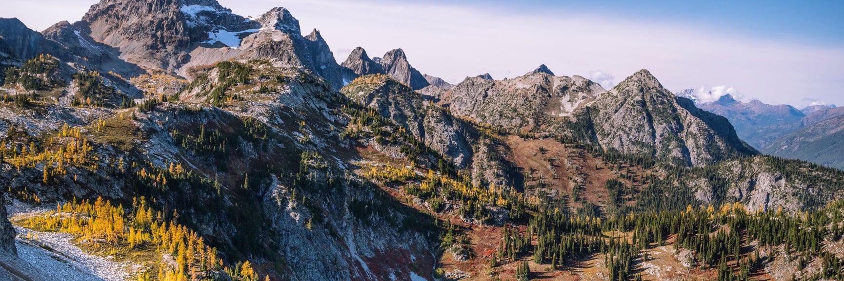 7 min readMaking The Most Of A Trip To The North Cascade National ParkRead post
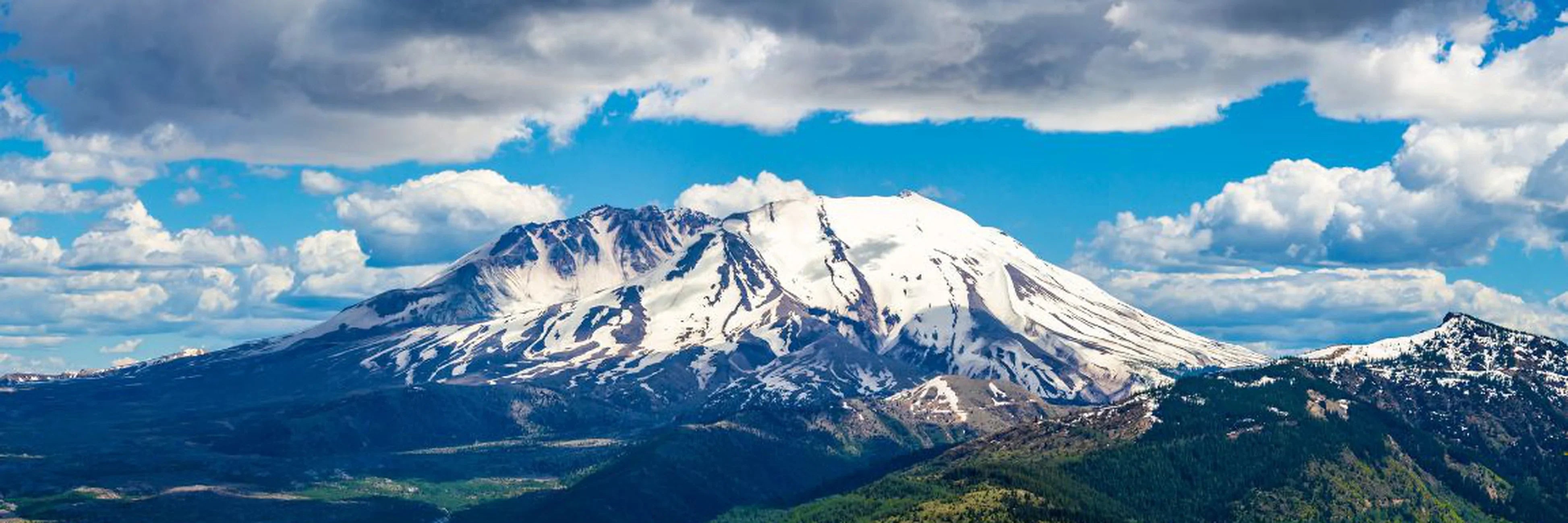 Adventure5 min readNational Parks Across the Cascade RangeRead post
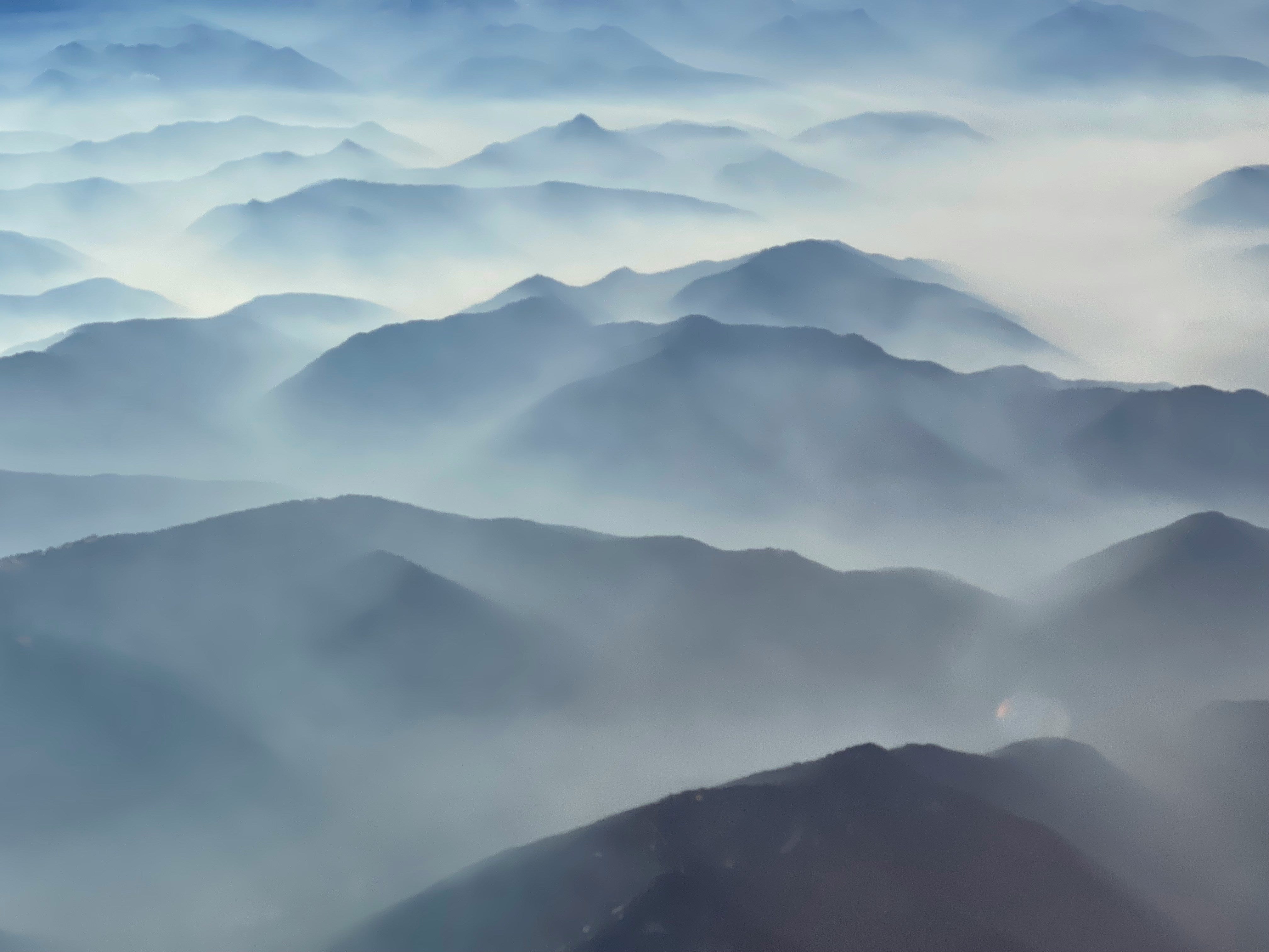 Adventure11 min readThe Cascade Volcanic ArcRead post
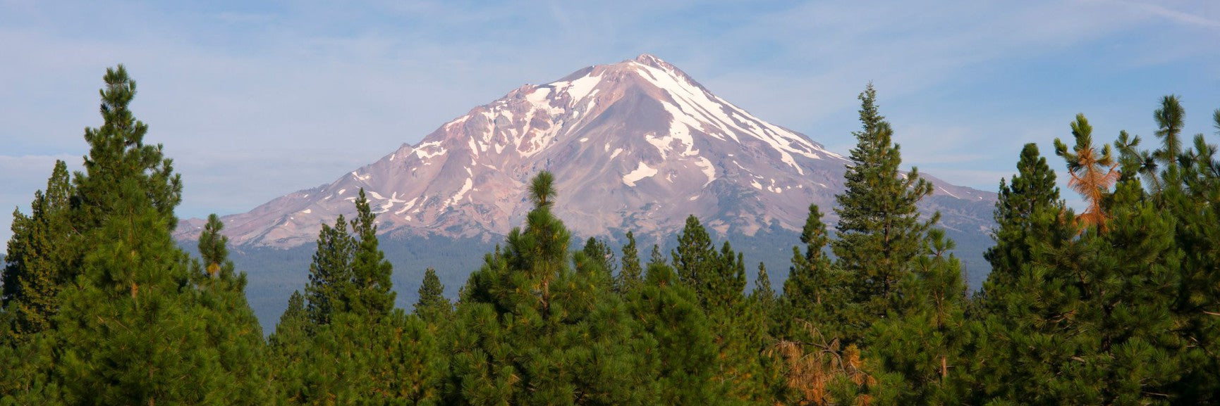 Adventure4 min readHow To Hike The Cascade PassRead post
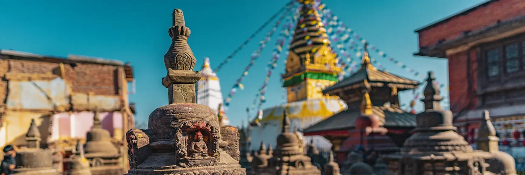 Adventure6 min readVisiting Swayambhu Mahachaitya, the Monkey TempleRead post
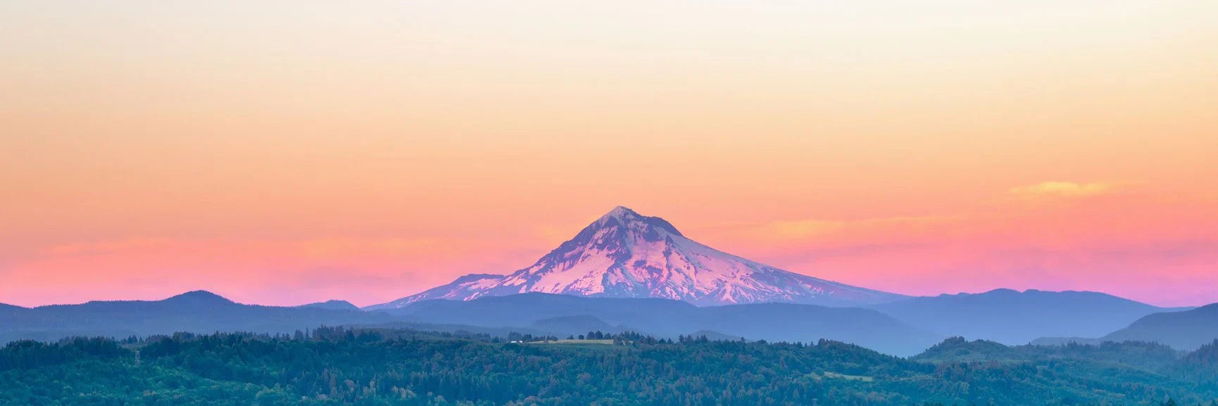 Adventure12 min readHow To Climb Mount HoodRead post


